


Mobile GIS - Sales & Hire
We specialise in providing you with affordable Mobile GIS solutions for Asset Management - from trees to highways...
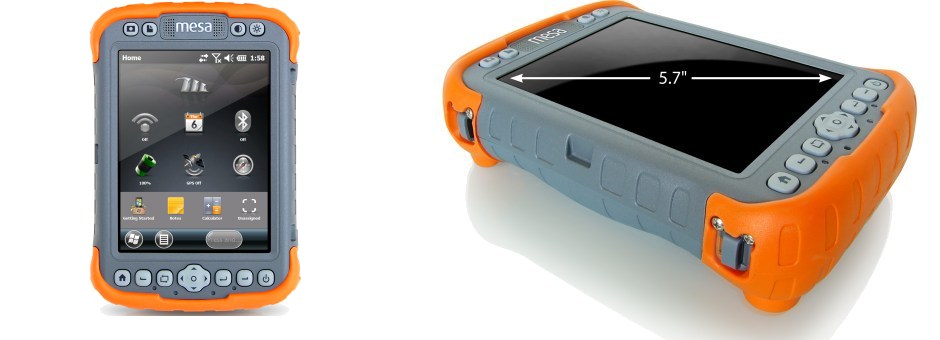
Mesa Rugged Notepad
A superb device and worth the extra money......
Juniper Systems - Mesa
A unique device that is rugged and has better screen size than other devices.
Easy to use in the field mapping
Data capture forms setup to your exact requirements, with drop down boxes, tick boxes and photographs.
Accurate GPS
With huge improvements to GPS technology you are able to capture better results and in many cases accurate background mapping can assist.
ESRI ArcPad 10
A comprehensive, easy to use out of the box, mobile GIS mapping solution.
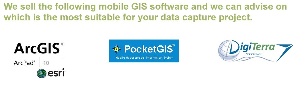
Mobile GIS Software
We sell Mobile GIS mapping software and can tailor them to your requirements.
Workflow for in the field Data Capture
The diagram briefly shows the workflow for the data collected and some of the outputs that can be produced.


The one stop consultancy services for:
- Arboriculture - Tree Safety Surveys
- BS5837:2012 Tree Surveys
- Forestry
- Countryside Management
- Landscape Architecture
- Ecology
- Noxious Weed Management
- Contract Management
- GIS Training / Analysis/ Map Production / Data Management
- Web Mapping WebGIS
- Mobile GIS Data Capture
- Mobile app for Tree Surveys
- UAV Aerial Imagery & Surveys
- School Catchment Mapping & Ranking
Mobile GIS Hire & Sales & Support
We specialise in providing Mobile GIS (Geographic Information Systems) mapping devices with integrated cameras and GPS for a variety of data capture uses. We provide the hardware the software and any training that might be required. This can either be onsite or within your office or a training room. We provide the all important support and we only sell products that we have used extensively ourselves.
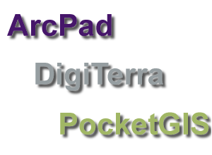
We have worked on large and small surveys and can help you capture the data in the most efficient way by setting up mobile GIS devices with software such as PocketGIS, ESRI ArcPAD and DigiTerra Explorer. Given our experience with mobile devices we can advise you on the best combination of devices and the right software. We provide bespoke data capture solutions that enable you to be efficient so that you spend longer surveying an asset than you do recording it. Having the right data capture form setup can dramatically increase productivity and provides the end users with better information to mange their assets.
These Mobile GIS units can be hired for a week, month or a year depending on your requirements. They are available with different software for mobile data capture depending on your needs and we can configure them specifically to your requirements. The units are sent by insured next day delivery and come complete with instructions and training videos as required. This means they can be quickly deployed to non GIS specialists and used effectively.
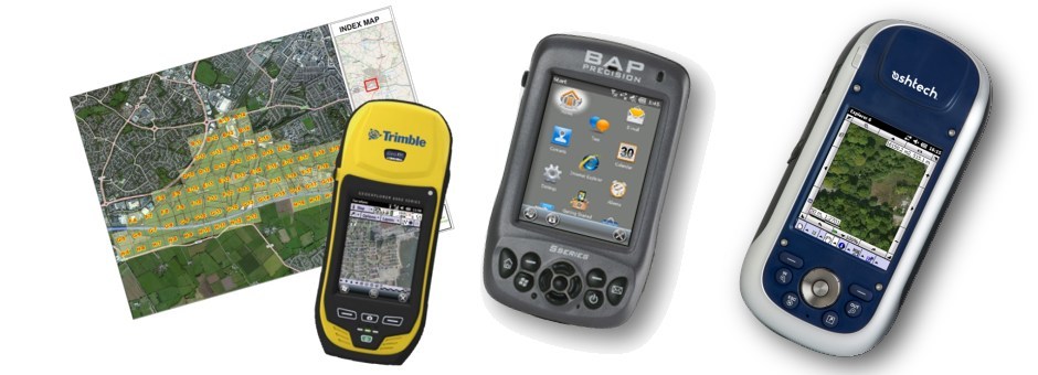
We currently have the following types of units available for short and long term hire:
- Spectra Precision / Ashtech Mobile Mapper 10 >>
- Spectra Precision / Ashtech Mobile Mapper 100 >>
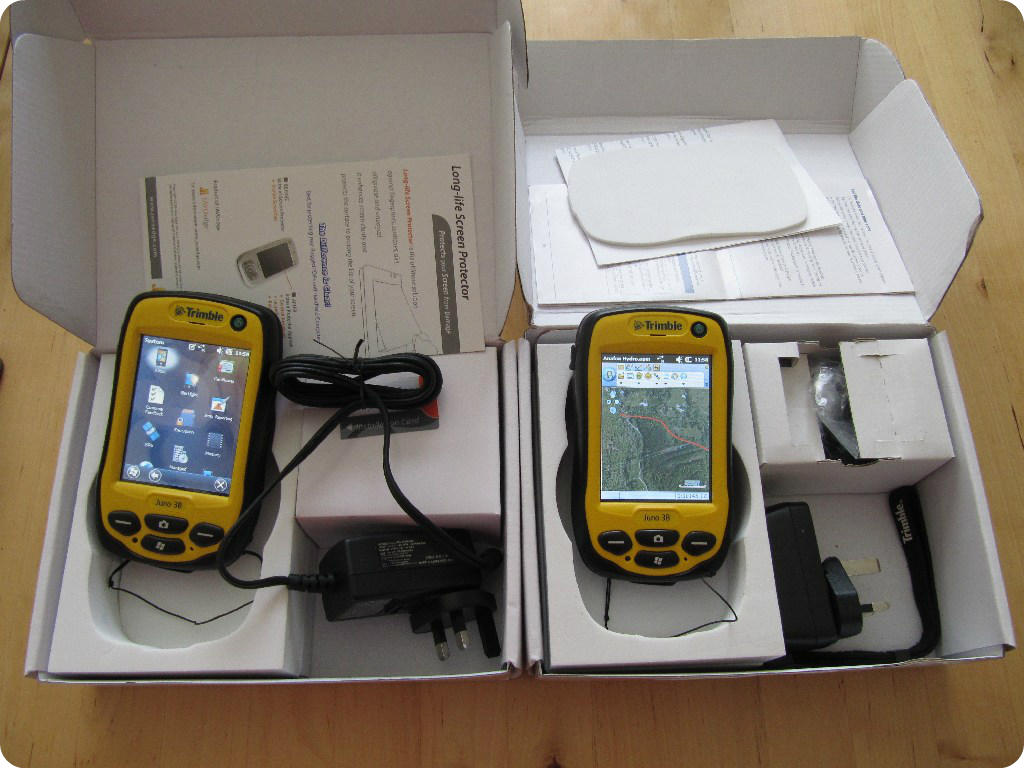
- Trimble Juno 3B >>
- Trimble T41 / Juno 5D >>
- Trimble Geoexplorer 6000 >>
- Trimble R1 / PG200 Bluetooth sub metre GPS >>
- SXBlue 2 Bluetooth sub metre GPS >>
- Juniper Archer 2 >>
- Getac PS535F >>
- Getac PS336 >>
- Flint 812H >>
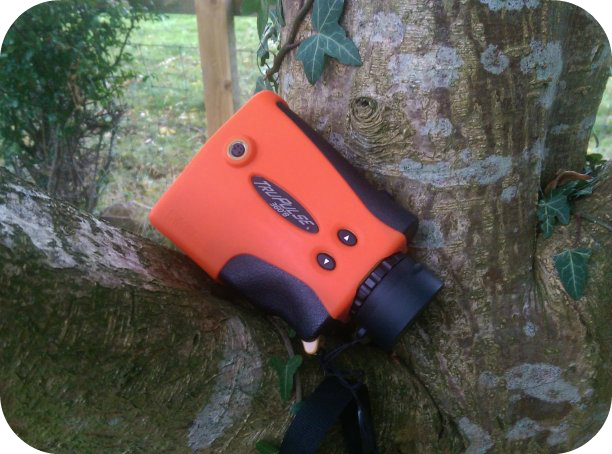
- Laser Technology TruPulse 200 Laser Rangefinder >>
- Laser Technology TruPulse 360B Laser Rangefinder (bluetooth) >>
Contact us today for our latest hire prices >>
GPS GNSS SUPPORT
We can offer support for mobile GPS hardware and can provide details of how to connect the devices to Windows 10 operating systems using Windows Mobile Device Centre for Windows Mobile devices.
See more mobile GPS device brochures here >>>>
How to choose a mobile mapping device?
1) YOUR APPLICATION - Each mobile application is different with unique requirements and there isn't therefore a perfect device for everyone.
2) HANDS ON - See a demo and get your hands on one to try int he field. Work out what you are going to use them for and how you will integrate it into your existing systems. You need to remember the word workflow.
3) COSTS - Set a budget for what you can afford to spend and remember they don't come with useable GIS software on them so you will need to purchase this. There is a costs vs. GPS accuracy decision and I get asked all the time which device to recommend. So why not ask!
4) Don't listen to all the sales pitches but instead speak to people who have used them in the 'rain and in vain' in your specific field of work.......
5) SALES & MARKETING - Don't believe all the GPS claims on the product sheets they are tested in a variety of conditions and the results will degrade under closed canopy conditions.
6) GPS ACCURACY of the device and the ruggedness are the two factors that drive up cost. With sub metre GPS adding significantly to your costs £700 to £4500 typically for the ones I sell. You need to ask yourself the question do you need the accuracy. For tree surveys on development sites assesed against BS5837 the accuracy of some trees might need to be captured to 0.5m but this can easily be achieved by having a good topographical survey and having that on a device and capturing on op of this. To use the correct term these are GNSS devices as GNSS stands for global navigation satellite system. GPS or Global Positioning System and the Russian GLONASS are Global operational GNSS's. In Europe we have Galileo which is expected to come operational from 2016 (read more here>>).
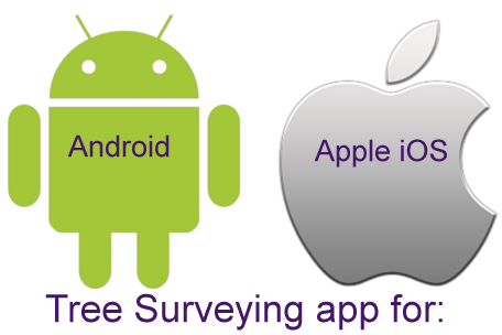
7) OPERATING SYSTEM - based on what software you choose you will need to ensure it is compatible and the main operating systems are; Windows Mobile, Google's Android and Apples iOS.
8) SOFTWARE - What GIS mapping software are you going to use on your device? the devices often dont come with anything. There are a variety of different mobile software and all have strengths and weaknesses. The main ones for Windows mobile devices is: ArcPAD 10, PocketGIS, DigiTerra 8.
-
We also have a new mobile app that can be used for tree surveying and this links directly to a web mapping system. This has had several years in development and currently has over well over 1 million trees in the system. The mobile app works with Android devices as well as Apple iOS devices (iPhones, iPADs). Sub metre bluetooth GPS units can be connected to these devices where the increased accuracy is needed. Further details area available here >>.
9) SCREEN SIZE - This is an important consideration and is the screen daylight viewable in bright sunshine. The larger screen sizes of a tablet have shorter battery life. Some of the tablets you can buy are not rugged and the ones that are can be heavy for all day use. The Juniper Mesa below is relatively light but very rugged with an excellent screen.
10) WEIGHT - Some devices are really heavy due to the battery and ruggedness needed to protect them if you are using them all day it maybe a consideration.
11) RUGGEDNESS / WATERPROOF - If you drop it will it survive? and is it waterproof, as you can guarantee the sun wont be shinning when you are under pressure to deliver that all important survey. Will it operate in extreme weather conditions and everyday abuse (IP54 rated, MIL-STD 810G). Ruggedness comes at a cost.
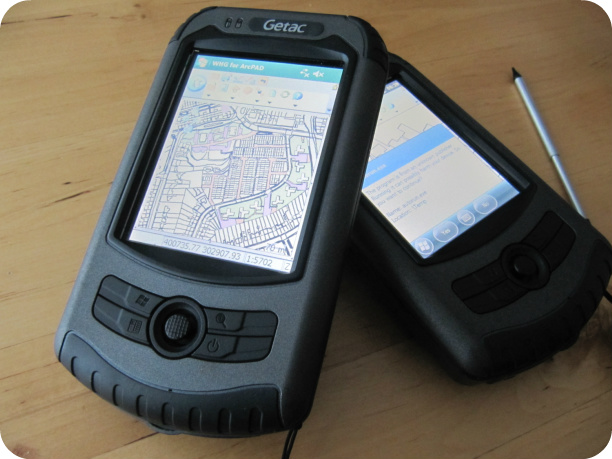 GETAC
PS535F click for brochure here >>>>
GETAC
PS535F click for brochure here >>>>
12) BATTERY LIFE - There would be no point having a device that ticked all your boxes but then lasted 5 hours when you need it to last 8 hours. Check what you need and how you can charge them in the field such as car charges etc. spare batteries. Some have hot swappable batteries.
13) PROCESSOR SPEED - Devices typically range from 800mhz to over 1ghz and for intensive applications the faster the processor the better especially for redrawing large areas of mapping.
14) RAM & STORAGE SPACE - Most come with enough RAM and adequate storage which often can be upgraded cheaply by adding a micro SD card.
15) MOBILE DATA (4G/3G/H+,E,G) - Do you need one that has a mobile data SIM card for transmitting data that you have collected. Some can be used as phones but I would avoid these as your own mobile will be far better for functionality.
16) THEFT APPEAL - could be a consideration depending on where you are working I have always gone for devices that fit in my pocket for this reason.
17) INTEGREATED GPS/ EXTERNAL BLUETOOTH GPS - Technology is developing quickly and there are some good bluetooth GPS that provide sub metre GPS accuracy that could be linked to a smartphone. Or you may want one device rather than carrying many items.
18) WIRELESS CONNECTIONS - Most devices will come with bluetooth and wifi and should be a consideration where you might want to connect a laser rangefinder or where you might need to send the collected data over WIFI.
What is GNSS...GPS? click here
GNSS stands for global navigation satellite system of which Global Positioning System (GPS) and the Russian GLONASS are different systems. In Europe we have Galileo which is expected to come operational from 2016 (read more here>>).
For further details please see our Mobile mapping for Tree Surveys leaflet and are Downloads page >>Click Here.
Factors Affecting GPS Accuracy?
1) Number of visible satellites. Multi GNSS capability such as those with dual frequencies can access both GPS, GLONASS which allows for better accuracy throughout the day.
2) Signal bouncing off objects such as trees and buildings (mulitpath).
3) Signal strength.
4) PDOP - Position dilution of precision - Find out more >>>
5) Differential correction (WAAS, Post processing).
6) Satellite elevation.
7) Occupation time (stand still and average the readings for better accuracy).
8) User error.
9) Weather - Ionosphere and troposphere delays.
10) GPS chip and antenna design within the unit.
So as with any type of survey the factors that affect its accuracy need to be understood.......as a general comment devices that can use GLONASS as well as GPS yield better results with faster position fix times.
Speak to us as we can help you....
Surveying Guidelines
The Ordnance Survey have produced some good guidance on surveying using GPS.These surveying guidelines are intended for surveyors who are acquainted with Global Positioning System (GPS) technology and need more information on national coordinate systems and positioning infrastructure. Click Here to read >>>

-
James England NDF, BSc(Hons)For, MicFor
Consultancy: GIS - Forestry - Arboriculture - Website Design